![]() MapSnaps
MapSnaps
Your Scenic Guide to the Great Outdoors
|
|
|
|
|
TrailPhotos.com
Your Scenic Guide to the Great Outdoors |
|
|
|||
|
Trails :
TrailPhotos Index
|
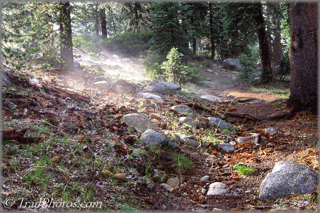
Hwy. 88 to N. Yosemite TrailPhoto Gallery - Alpine Lake / Elephant Rock Lake Trail Sun mist rises from the hail after a brief but intense summer afternoon storm Stanislaus National Forest / Carson - Iceberg Wilderness (Off Highway 4 Area) (Also see this photo at: Flickr) * Alpine Lake / Elephant Rock Lake Trail. This TrailPhoto Guide is now available * Roundtrip trail distance = 10.3 miles. Difficulty = Strenuous. Scenic value = 9 / 10. * Guide contains 14 color photos, plus maps. Acquire this Guide at Scribd.com.
Lots of woods, lots of lakes and ponds, a few meadows, and even an old timey cabin still standing along this trail bring a variety of interest. Somewhat of a long loop, it's less an exploration of high mountain peaks than a jaunt through other features of a forested wilderness. This is a good trail to take from a basecamp at Alpine Lake, and it reflects the subtle charms of the lands on the western side of Ebbetts Pass. The lakes and ponds are spread out enough to keep bringing expectations of another resting place and trailside attraction along the way, and occasionally, granite peaks appear for good measure.
To preview or acquire this TrailPhoto Guide, complete with all the color photos and their mapped locations, area and topo maps, directions, and the trail guide text, please visit Scribd.com. (This TrailPhoto Guide is now available at the Scribd website to preview, or acquire for $1.50). Or, view a free, complete TrailPhoto Guide Sample at Scribd.com first. This sample includes a TrailPhoto Guide to the Eagle Lake Trail in the Lake Tahoe Region (Other TrailPhoto Guides are also available with free preview pages and for purchase from MapSnaps at Scribd.com).
Back to Highway 88 to Yosemite TrailPhoto Guides Thumbnail Photo List and Map
Home | What's New | FAQ | User Notes | About Us/Contact © 2000-2010 MapSnaps All rights reserved |
||