![]() MapSnaps
MapSnaps
Your Scenic Guide to the Great Outdoors
|
|
|
|
|
TrailPhotos.com
Your Scenic Guide to the Great Outdoors |
|
|
|||
|
Trails :
TrailPhotos Index
|
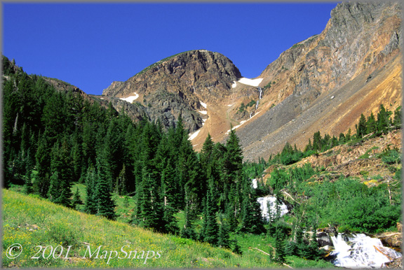
Hwy. 88 to N. Yosemite TrailPhoto Guides - Lundy Canyon Trail Lakes, falls, copper peaks, canyons, forests and meadows: what else you want ? Inyo National Forest / Hoover Wilderness (Also see this photo at: Flickr) or see Extra Large version of this photo in the TrailPhotos.com Gallery * Lundy Canyon Trail in the Off Highway 395 Area. * Difficulty = Strenuous. Scenic value = 10 / 10. * This TrailPhoto Guide is under development. Please check back again for updates.
You can view a free, complete TrailPhoto Guide Sample at Scribd.com. This sample includes a TrailPhoto Guide to the Eagle Lake Trail in the Lake Tahoe Region (Other TrailPhoto Guides are also available with free preview pages and for purchase from MapSnaps at Scribd.com).
Back to Highway 88 to Yosemite TrailPhoto Guides Thumbnail Photo List and Map
Home | What's New | FAQ | User Notes | About Us/Contact © 2000-2010 MapSnaps All rights reserved |